
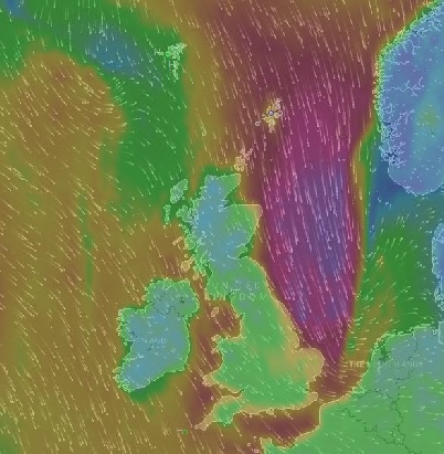
The mesmerizing app (left) called windyty shows animation of the northerly winds that caused the storm surge at 0100 on 14 January 2017. Strong northerly winds coming right down the North Sea pushed water south along the east coast of England. We could check real time tides for various east coast towns as the
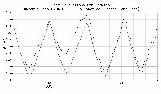
surge progressed down the east coast. The graph on the right shows recorded tides at Harwich in blue dots against the predicted (normal) tide in red. The low tide on 13 January was about 1.5m higher than it should have been so as the tide rose we expected the high tide to be very high indeed. The environmental agency turned up to shut the towns flood gates, with us on the outside of course, and we loosened some ropes and made ready. At midnight on 13 January you can see that the upward surging tide checked for a period and then the high water online reached about 0.7m higher than it should have. We put this down to timing as the storm surge seemed to have arrived before the predicted high water, meaning that the 2 would coincide to give a very high water. It was also down to a last minute change of wind direction from Northerly to North easterly which started blowing the surge off the shore. The Christmas period brought several storm surges which flooded the quay and meant we had to find higher
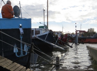
Ground to park the car. If the surge got much higher it would get into the electricity supply box on the quay and Lorna would need taller wellies to get back to the boat!